Overview of drone-enabled agriculture
Drone-based crop monitoring and health assessment
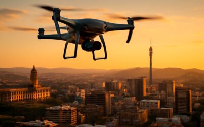
On sun-kissed farms across South Africa, a quiet revolution takes flight above the rows. Farmers report up to 20% reductions in water use when aerial sensing maps soil moisture and crop vigor, turning data into decisive action. This is how drones help in agriculture!
Overview of drone-enabled agriculture reveals an orchestration of data: overhead views translate into precise field zoning and smarter irrigation for South Africa’s farms. Drones gather high-resolution imagery, multispectral signals, and thermal cues to reveal stresses the naked eye might miss.
Drone-based crop monitoring and health assessment gives farmers a live narrative of vigor and vulnerability. By tracking phenology, moisture stress, and patchy growth, fields respond with a quiet grace to weather and season.
Irrigation optimization with drone data
On South Africa’s sun-drenched farms, irrigation optimization has become a quiet decision-maker. Drones sweep fields with high-resolution imagery, multispectral signals, and thermal cues that translate into practical water strategies. This is how drones help in agriculture—by turning scattered data into a living map of soil moisture and crop demand, letting farmers choreograph irrigation with conscience and efficiency.
With drone data, scheduling becomes zone-aware rather than blanket watering. Evapotranspiration models, soil-water balance, and canopy signals converge to guide precise irrigation, reducing waste while maintaining yields.
- Exact soil moisture targets per field zone
- Variable-rate irrigation that aligns with crop growth stages
- Early stress detection to prevent yield losses
In this way, the South African landscape witnesses a delicate balance between technology and stewardship.
Pest detection and early intervention via aerial surveys
Across South Africa, pest pressure stalks crops from the Highveld to the Karoo, and aerial surveys are changing the tempo of response. In field trials, targeted scouting with drones cut reactive spraying by up to a third when pests are detected early. This is how drones help in agriculture in practice, turning sky-level signals into ground-level actions.
- Discolored canopies signaling early stress
- Localized leaf curling and stippling patterns
- Thermal hotspots hinting at stressed zones
From canopy chatter to targeted treatment, the view from above makes pest management precise, economical, and less disruptive. South African growers value the balance of vigilance and restraint this technology affords.
Yield forecasting and data-driven planning
South African fields are waking to a quiet revolution: drones turning weather whispers into yield forecasts with stubborn accuracy. Across the Highveld to the Karoo, early adopter farms report up to 15% fewer planning errors when relying on drone-enabled yield forecasting.
Overview of drone-enabled agriculture: data streams from multispectral cameras, NDVI and soil moisture proxies to predict harvest windows and optimize planting density. This is how drones help in agriculture by turning canopy signals into data-driven forecasts that farmers can trust when setting contracts and pricing futures for the season.
- Enhanced yield forecasting precision
- Data-driven planning for inputs and irrigation timing
- Alignment with market windows and harvest calendars
From field prep to harvest readiness, drone-derived insights stitch together agronomy and economics, giving SA growers latitude to plan with fewer surprises and more confidence.
Precision Agriculture with Drones: Techniques and Tools
Multispectral and hyperspectral imaging for crop health
“The crop speaks in wavelengths,” a savvy South African farmer quips, and drones listen. Precision Agriculture with Drones opens a new lens on field variability, letting multispectral and hyperspectral imaging read the leaves from above.
Multispectral cameras grab bands beyond visible light, computing indices like NDVI and NDRE to flag vigor gaps. Hyperspectral sensors dive deeper, revealing subtle nutrient and disease signatures before symptoms bloom. Add thermal imaging to spot water stress, and you have a toolkit that translates soil whispers into actionable maps.
- Multispectral imaging and NDVI/NDRE for crop vigor
- Hyperspectral imaging for nutrient and disease signatures
- Thermal imaging for water stress and irrigation targeting
This is how drones help in agriculture—delivering precise inputs, reducing waste, and helping South African farmers steward scarce water with smarter planning.
Thermal imaging for water stress and plant vigor
From dawn to dusk, a drone’s quiet lattice of heat becomes my South African field’s compass. Thermal imaging paints a map of water stress, turning subtle warmth into actionable field notes. This is how drones help in agriculture—precision that speaks when leaves withhold their secrets.
Thermal storytelling pairs with real-time vineyard or row-narrow readings, enabling targeted irrigation and resource stewardship. A compact list of core tools accompanies this art:
- Thermal cameras with calibrated emissivity for reliable heat maps
- High contrast 3D canopy context from high resolution RGB visuals
- Georeferenced data layers that align with soil moisture platforms
Taken together, these techniques translate field variability into a single, actionable canvas—reducing waste, conserving water, and empowering farmers to plan with confidence.
Drone mapping and GIS integration
Precision Agriculture with Drones: Techniques and Tools reshapes South Africa’s fields. Drone mapping and GIS integration turn scattered notes into a single, scalable map you can query at dawn or dusk. This is how drones help in agriculture, turning data into decisions. In practice, orthomosaic maps and georeferenced layers reveal boundary changes, soil variability, and crop cycles—without trudging the veld.
- Ortho-mosaic mapping with RTK/PPK accuracy
- GIS-ready data layers that stitch soil, moisture and canopy data
- Cloud dashboards and mobile access for field teams
These tools keep plans grounded, even as weather and markets shift.
Variable rate application and site-specific farming
One drone flight can map a field the size of a rugby field in minutes, turning precision into habit rather than guesswork. In precision agriculture, variable rate application and site-specific farming illuminate where nutrients are needed and where they are not, shaping input decisions with confidence. These techniques translate soil variability and canopy signals into actionable prescriptions, boosting uniform yields across South Africa’s maize, citrus, and wine regions.
- Prescriptive maps that guide variable-rate fertilizer and lime application with surgical precision.
- Site-specific herbicide and seed placement that protect beneficials and cut inputs.
- Cloud dashboards and mobile access so field teams respond while workers are in the veld at dawn or dusk.
Ultimately, this approach grounds strategy in observation, not assumption, and reveals how drones help in agriculture. It speaks to South Africa’s need for scalable, data-informed farming that respects the land and communities.
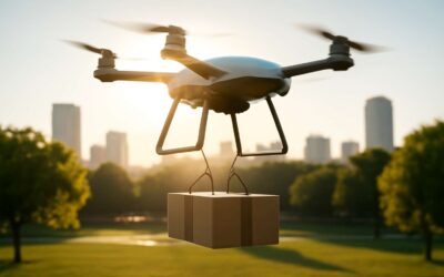
Crop Management Applications: From Planting to Harvest
Crop planting pattern analysis and seedling validation
Farmers report up to 20% more uniform stands when drone-assisted planting is part of the plan. From planting pattern analysis to seedling validation, drones provide a field-wide audit of stand establishment as crops push through the soil.
- Accurate plant population counts across fields
- Early detection of gaps, crowding, and row misalignment
- Seedling vigor checks and uniform emergence validation
This is how drones help in agriculture: by mapping planting patterns and validating seedling emergence, enabling stand uniformity checks before the first fertilizer pass. In South Africa’s varied landscapes, that clarity translates into fewer gaps and more predictable, well-ordered rows.
Irrigation scheduling and water resource optimization
Across South Africa’s farming heartland, smarter irrigation saves water and boosts yield. Pilot farms report up to 30% water-use efficiency gains when drone data guides scheduling and soil-moisture mapping. From sun-browned Karoo to citrus belts along the coast, precision irrigation responds to every microclimate. This is how drones help in agriculture.
- Soil moisture mapping across paddocks informs zone-specific irrigation and deficit irrigation strategies
- Evapotranspiration estimates and canopy temperature signals time watering with the plant’s needs
- Early detection of irrigation gaps, runoff, and row misalignment helps prevent water waste
- Water budgeting and reservoir planning align with seasonal demand and crop calendars
Across variable landscapes, drone-guided scheduling fuels healthier stands from planting to harvest while protecting scarce resources. In the story of South African farms, data becomes rainfall’s ally and soil’s confidant, turning restraint into reliability and uncertainty into growth.
Nutrient management and fertilizer planning
In South Africa’s sun-bronzed paddocks, nutrient management is a moving target. Drones map soil fertility and wetness across fields, turning guesswork into precise fertilizer planning. From planting to harvest, aerial data reveals where nutrients are needed, how intensely, and when—letting farmers feed the root zone with confidence rather than conjecture!
When you ask how drones help in agriculture, nutrient management and fertilizer planning become patient, data-driven crafts.
- Variable-rate nutrient placement based on real-time maps
- Soil-test aligned blends for organic and mineral amendments
- Crop-need forecasting tied to seasonal calendars
Disease detection and stress monitoring for timely interventions
From planting to harvest, how drones help in agriculture unfolds as a patient, data-driven craft in the field. Disease detection and stress monitoring arrive as early alerts, letting farmers nudge management decisions before symptoms spread. In South Africa’s sunlit paddocks, aerial scans read leaf color, canopy density, and heat signatures to reveal trouble spots, drought pockets, and nutrient imbalances—often before a farmer can see them from the tractor seat.
- Germination and stand establishment checks across rows
- Canopy development and vigor mapping for uniform growth
- Spotting anomalies that trigger timely interventions
With flight plans aligned to phenology calendars, drone data informs when to intervene and how intensively, turning a field into a set of responsive zones rather than a single uniform block.
Harvest readiness assessment and yield estimation
Harvest readiness is the hinge between bloom and bin. Drones glide over the landscape, turning field signals into actionable readiness and yield estimates. In South Africa’s diverse climates, the data reveals when to harvest and how much to expect, guiding logistics and packing plans.
- Canopy maturity and density trends mapped over time
- Fruit set, pod fill, and stand uniformity for harvest sequencing
- Moisture gradients and post-harvest handling requirements
From binding the timing of harvest to projecting tonnage, imagery and analytics blend into a narrative of stewardship—speaking to logistics, storage, and market windows.
This is how drones help in agriculture in practice.
Operational and Economic Benefits of Drones in Agriculture
Cost savings from reduced pesticide use and fewer field trips
South African farms are discovering a quiet revolution at sunrise: drones that cut costs as surely as they cut through fog! In practice, pilots report pesticide bills thinning and field visits shrinking, while coverage remains thorough. This is a tangible perk of modern agriculture—fewer trips, sharper targeting, more reliable schedules. how drones help in agriculture isn’t a slogan; it’s a growing, on-farm reality that pays for itself in months and keeps labor lean.
- Lower pesticide use through precise, targeted application that minimizes drift and runoff
- Fewer field visits required as drones deliver timely data and remote scouting
In a country where costs press hard on margins, the operational gains translate to sturdier budgets and steadier harvests, letting farmers reinvest where it matters most.
Labor efficiency and safety improvements
Across South Africa, some farms report labor hours cut by up to 25% after adopting drone fleets. This is how drones help in agriculture. Operational gains come from remote scouting, precise flight planning, and real-time risk assessment, letting crews shift from routine checks to targeted, skilled work. The payoff is a leaner, safer workflow and more reliable harvest cycles, even on tight budgets.
Labor efficiency and safety improve as drones reduce exposure to harsh conditions and heavy lifting. They enable safer audit trails and quicker incident response, protecting workers and crops alike.
- Reduced manual field visits and fatigue
- Remote sensing lowers chemical exposure
- Better scheduling minimizes field traffic and accidents
In South Africa’s challenging markets, that safety margin translates into predictable costs and steadier livelihoods.
Return on investment and payback period
Across South Africa’s farms, a 25% cut in labor hours after drone adoption isn’t a rumor—it’s a practical offset to budget pressures. This is how drones help in agriculture. The initial outlay is balanced by faster decision cycles, targeted inputs, and better crop protection, compressing the payback window into a single season on many operations.
- Lower operating costs from reduced field visits and manual checks
- Faster harvest planning and market timing improves revenue windows
- Flexible financing and tax incentives shorten payback period
Even on tight budgets, the economics stack up when you consider uptime, risk reduction, and hybrid operations that blend drone assets with traditional teams.
Regulatory considerations and data privacy
Drones reshape the day-to-day rhythm of farming. Operationally, they slash field visits, enable rapid weather- and crop-status checks, and shorten decision cycles. Economically, uptime and precise inputs translate into steadier margins and faster ROI, even on tighter budgets. In this landscape, how drones help in agriculture is no longer theoretical—it’s a practical lever for resilience and productivity!
Regulatory considerations and data privacy ethics shape every flight. In South Africa, operators navigate SACAA requirements and local permissions, while POPIA governs how imagery and sensor data are stored, shared, and retained.
- Regulatory: SACAA licensing, permit for specific flight operations, and adherence to altitude and airspace rules.
- Data privacy: POPIA compliance, data ownership rights, access controls, and clear consent for image capture on private land.
- Security and retention: encrypted storage and defined data retention policies to prevent unauthorized use.
Getting Started with Drone Solutions on the Farm
Choosing the right drone specifications for field size and crops
In a country where a single dry spell can redraw a farmer’s year, the sky is no longer a backdrop but a field agent. A veteran citrus grower once said, “The field tells a story from the sky.” Getting started with drone solutions on the farm feels less like gadgetry and more like inviting an impeccably punctual foreman onto the team.
Choosing the right drone specifications for field size and crops matters as much as the seed in the ground. For large tracts, prioritise endurance and reliable data links; for delicate rows, high-resolution imaging and flexible sensors win the day. Consider these essentials:
- Field size and flight time: bigger fields demand endurance and efficient routing
- Sensor suite: multispectral or NDVI-capable cameras for crops
This is how drones help in agriculture, turning sky data into field-ready insight and quietly reshaping planning timelines for seasons yet to come.
Data platforms, processing, and analytics tools
Getting started with drone solutions on the farm doesn’t require a tech baccalaureate. A recent SA survey suggests farms using drone data can cut decision time by up to 30%, turning morning worry into afternoon action. Data platforms sit at the center, stitching imagery into a narrative the team can act on—how drones help in agriculture by translating sky imagery into field-ready insights.
Processing and analytics tools should feel intuitive, not inscrutable. We want pipelines that take raw images, build orthomosaics, compute NDVI, and push alerts to the team, all while keeping privacy and compliance in check. Look for compatibility with common farm maps and a dashboard that highlights hot spots.
- Cloud processing for scalable analysis
- GIS dashboards for field maps
- AI-driven alerts for anomalies
With these in place, the farm speaks in data, quietly guiding planning for seasons to come—how drones help in agriculture, turning pixels into field-ready strategy.
Training, safety, and compliance for farm operators
Across South Africa, a recent SA survey shows decision times shrink by up to 30% when drone data informs the field. Getting started with drone solutions on the farm starts with training, safety, and compliance for operators—the practical trio that keeps sky-scapes from becoming a bureaucrat’s backlog. For many, the question how drones help in agriculture becomes practical once onboarding clears the air and you learn to translate the view into action.
- Hands-on flight planning and basic piloting skills
- In-field safety briefings and PPE
- Data handling basics and privacy-friendly workflows
Maintain licenses, insurance, and maintenance logs; keep to local regulations; schedule periodic refreshers. That is how drones help in agriculture, when training meets discipline.
Vendor selection and budgeting
Getting started with drone solutions on the farm begins with a discerning vendor. This is how drones help in agriculture—by turning aerial data into timely decisions, not merely collecting pretty pictures. The right supplier offers dependable local support, sensible privacy safeguards, and transparent maintenance terms. Specs matter, but a partner’s reliability during busy planting and harvest windows matters even more.
- Local service network and spare parts
- Transparent maintenance, warranty, and update schedules
- Seamless data integration with existing platforms
- Flexible budgeting options: purchase, lease, or pay-as-you-go
Budget thoughtfully by mapping field size, flight cadence, and data needs, then align with the vendor’s roadmap for updates and support.

0 Comments